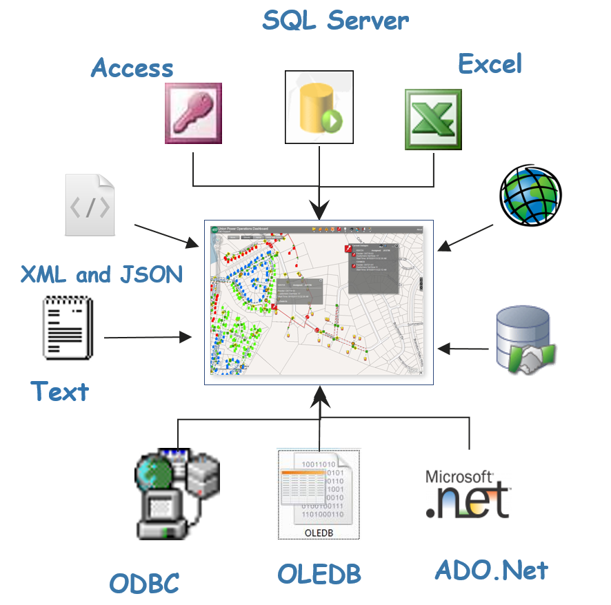
Import EXT is a GIS service that provides automatic one-way integration from any OLEDB, ODBC, ADO.NET, JSON or XML data source including;
1. Oracle
2. SQL Server
3. Microsoft Access
4. Text Files
5. Microsoft Excel
6. XML and JSON Web Services
7. ESRI Geodatabases or Shapefiles
8. Modbus TCPIP
9. FTP and sFTP web servers
10. Address data using Geocoding
Import EXT is the “missing link” for merging; meter information, historical outages, accounting, billing, right of way, work orders, AVL and other datasets into a GIS operations dashboard.
Import EXT can create or update ESRI geometry from related feature classes, XYZ-coordinates, latitude-longitude coordinates, SQL Server geography, OGIS Well Known Text, and OGIS Well Known Binary fields.
Import EXT sends a periodic email summarizing the number of records that were added, changed, or deleted.
Import EXT executes in ArcMap, ArcCatalog, ArcGIS Server, as a scheduled task or as a Windows service.
Import EXT automatically converts field types while importing.
Import EXT supports multiple primary keys.
Import EXT supports ArcGIS for Server and ArcGIS for Desktop
Download This PDF and get more information.